Castillo de Cornatel - La Mirada Circular

Templar Castle of Cornatel

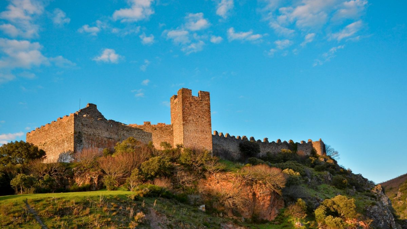
The Templar Castle of Cornatel is located on a rocky promontory to the east and by a 180 meters to the north, along which the Rioferreiros stream runs. Regarding the other two easily accessible flanks, the castle it is protected by a single wall covered by a crenellated defensive round walk. Through this side we access the castle, via a stone and wood staircase.

The Templar Knights would use it as their fortress until 1312.

In 1843 the castle was used as a romantic setting for one of the main Spanish historical soap operas – El Señor de Bembibre – written by the local writer Enrique Gil y Carrasco:

«At last, turning to the left and entering into a deep, craggy ravine with a stream running along its bed, the imposing outline of the castle, already illuminated by the rays of the sun, appeared on the crest of the mountain, while the cliffs around it were still dark and covered in mist. A sentry was keeping watch and his armor shone brightly as he walked up and down on the battlements. It is hard to imagine a more sudden change than that which the traveler experiences entering this deep gorge. The nature of this place is rough and rugged, and the castle itself, whose walls are cut out against the sky, resembles a narrow watchtower between the huge boulders that surround it and the hills above. Although nowadays the moat has been filled in and the inner chambers have collapsed with the weight of the years, the skeleton of the castle still stands and presents the same spectacle as it then offered from a distance».

Fragment of chapter X of El Señor de Bembibre

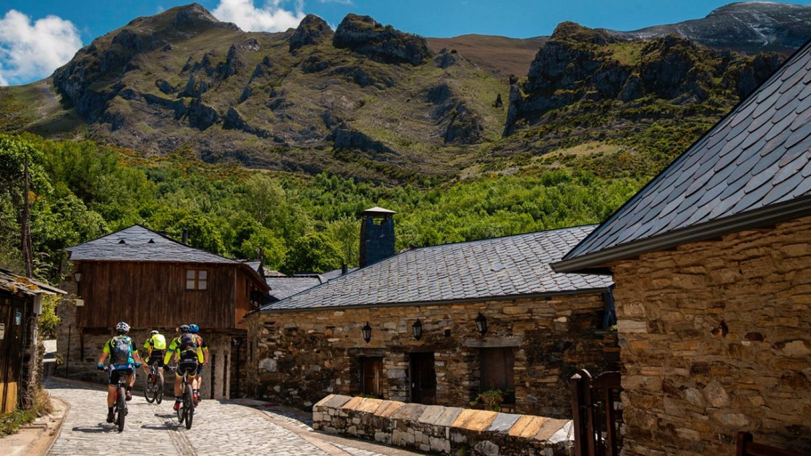
Without doubt, this castle is hidden treasure in the Bierzo Mountains and guard of Lás Médulas and of the Aquilian mountains.

Castillo Templario de Ponferrada - La Mirada Circular

Templar Castle of Ponferrada

With 8000 m2, the Templar Castle of Ponferrada is considered one of the most important castles in the northwest of the Iberian Peninsula and main symbol of the city of Ponferrada.

It’s military architecture was influenced by the settlers of this territory, which have left their mark through successive constructions and improvements. Declared a National Monument in 1924 and also Site of Cultural Interest, was only rehabilitated in the end of the 20th century mostly focusing in recovering the walls and dependencies of the Castle. The result was a multifunctional monument, where different types of social activities and events still take place.

The Castle also has a privileged location: from the geographical point of view it has always been a mandatory cross point between the Meseta and Galicia for the Santiago Pilgrims; from the tactical perspective, its promontory location on the banks of the Sil River has always allowed it to protect the territory and the Camino. Lastly, it is also a landmark of the Ponferrada old town.

PEÑALBA-edit

La Tebaida Berciana – Valle del Silencio

Peñalba de Santiago is one of the most iconic villages of the region, located in the valley of the Oza river, better known as the Valle del Silencio (Silence Valley). It is in the middle of the large forests of chestnut and oak trees that the traditional Peñalba de Santiago housing style can be found. It is formed by an agglomeration of stone houses with slate roofs and wooden balconies in the form of a corridor, which run staggered towards the valley.

Peñalba de Santiago is a medieval town that was considered monumental heritage in 1976, where one can enjoy a great landscape and the monumental beauty of its architecture as well as the tranquility offered by the majestic Valle del Silencio. Within this beautiful site it should be highlighted the Church of Santiago de Peñalba, one of the masterpieces of the Mozarabic art:
The Church of Santiago de Peñalba is one of the few remaining parts of the old convent of Peñalba de Santiago, founded in 916 by San Genadio and used as a place of recollection. The monastery did not last for long, disappearing in the 12th century.

Nowadays, only the Church remains well preserved in spite of its antiquity. The Church was built after the Monastery, having been consecrated in 975 and later restored between 1968 and 1976. Due to its dimensions it is considered as a small church, however demonstrating a very well harmonized and proportionate set. The temple has a central nave with a rectangular base, divided into two bodies, to which small units used as a sacristy are attached. Therefore, the church takes the form of a false Latin cross. It is oriented from East to West, holding a beautiful entrance framed by an alfiz, with two twin horseshoe arches in a clear sign of byzantine influence. On the inside, the canyon dome (also of a marked byzantine influence) and the nine columns of white marble and granite should be highlighted.

On the outside of the temple we can highlight the door of the church, which consists of two geminated horseshoe arches on three columns of attic-based marble, and capitals of acanthus leaves under triple nacela crest, which forms a unique set in the whole world.

It should also be stressed the numerous paintings and inscriptions inside, which have been covered by the inconvenient plaster interventions that the temple has had along the time. As a symbol of the temple we can contemplate the 10th century Votive Cross of Azófar offered by Ramiro II, which has an inscription dedicated to the Apostle Santiago. This cross is currently being exhibited in the Provincial Museum of León.

Recently named one of the most beautiful villages in Spain and declared of Site of Cultural Interest in 2008, Peñalba is famous for its beautiful network of ancient typical streets and houses, its Mozarabic church and its enviable location in-between the Bierzo mountains.

Ancares La Mirada Circular

Ancares

In the landscape of the Ancares valley we can find villages such as Pereda de Ancares, which stands out above all for one of the most characteristic architectural features in this area: Las Pallozas. The origin of the Las Pallozas arises from old Celtic houses. The main characteristic of these houses is the fact that all the actions of daily life used to focus in a single body, with the haystack and the stable close to the house. The floor plan of these houses has an elliptical or rectangular form, with hardly any windows. Another feature is the roof, built in wood and caked straw called “teito”. The interior of the Palloza was divided by zones: one destined for cattle and another destined for housing known as “fire”, where food was cooked producing also the heat for the whole house.

Near the Palloza we can find another characteristic type of construction: El Hórreo, which has some architectural similarities with the Palloza. El Hórreo almost always shows up built in wood with a thatched roof and supported on stone pillars that used to protect it from humidity and rodent attacks, since it was used as a pantry for food and grain harvested by the inhabitants of the Palloza. Nowadays, the Pallozas are a great tourist attraction of these valleys, becoming true living museums of the life of the ancestors.

El Campo del Agua (water field) is one of the most remote places of the Los Ancares. Currently uninhabited, it is however a true reflection of the daily life of the closest ancestors. The village of Campo del Campo del Agua is only made of Pallozas and it was one of the best preserved monumental sets of traditional architecture in all of Europe until 1989, when most of the existing 22 Pallozas burned down.

This small village is noteworthy for its monumental character highlighting the Pallozas as a key cultural and tourist icon of this territory.

MEDULAS 2-edit

Las Médulas

Las Médulas is a natural landscape formed by an old Roman gold mining operation, being considered the largest open-pit gold mine in the entire Roman Empire.

The engineering work carried out for gold extraction involved the modification of the ground conditions, resulting in a landscape of reddish sands, currently partially covered with chestnut and oak trees. It is considered a cultural landscape and it is labelled as “Cultural Park”.

The system used was called Ruina montium. Water from mountain streams was channeled and dammed at the top of the gold exploitation; the mountain was perforated by a network of mining galleries, releasing the water through them. The water pressure dragged the gold lands to the washeries. The hydraulic system of Las Médulas is the most spectacular of all that are known, for the amount of water used, as well as for the length and the large number of branches of its channels.

After being abandoned in the third century, chestnut trees grew where the gold mines used to be. These trees can be seen throughout the route in all its spectacular forms.